Using remote sensing to prepare for and respond to extreme events
Status: Completed
Operational Plan: 2019 - 2020
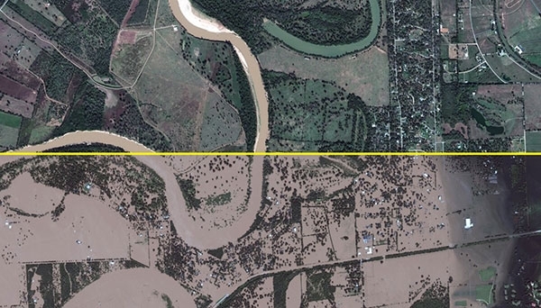
Remote sensing applications for early warning systems and climate change monitoring play a significant role in disaster management. A number of applications exist, but providing relevant and timely geospatial information to first responders remains a challenge because of a lack of infrastructure allowing them to connect to these technologies. The objective of this project is to improve the capacity of emergency managers, first responders, and decision-makers to use real-time satellite imagery to complement existing tools and practices for preparedness and response to extreme events in disaster-prone regions.

Issues
- Satellite applications for early warning systems and climate change monitoring play a significant role in disaster management
- A number of applications exist, but providing relevant and timely information to first responders remains a challenge because of a lack of infrastructure that would allow them to connect to these technologies
Aim
- The CEC is building local and regional capacities for first responders, emergency managers, and decision-makers to gain access to and use real-time satellite imagery in preparing for and responding to extreme events
Deliverables
- Developed capacities for local and regional first responders, emergency managers, and other decision-makers to use real-time satellite imagery in responding to droughts, floods, and wildfires
Contact
For more information about this project or to partner with us, contact:
Orlando Cabrera-Rivera
Head of Unit, Environmental Quality


