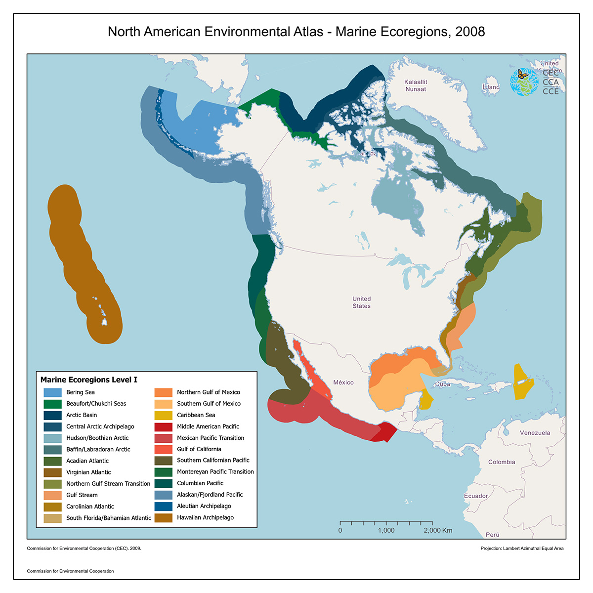
Marine Ecoregions
Map type: Marine Ecosystems
These marine ecoregions are areas of general similarity in terms of physiographic, oceanographic and biological characteristics, which fall within the Exclusive Economic Zones of the North American countries.
These marine ecoregions are constructed as a spatial framework with three nested levels.
The Level I marine ecoregions displayed in this map capture ecosystem differences at the largest scale by grouping together large water masses and currents, enclosed seas, and regions of coherent sea surface temperature or ice cover.
The seaward boundaries of the marine ecoregions as mapped are approximate and do not represent the seaward boundaries of the ecoregions or an exact boundary of the Exclusive Economic Zones of the three countries.

Contact
Questions about the North American Environmental Atlas? Contact:
Dominique Croteau
Project Lead, Geospatial and Environmental Information