Irrigated Areas
Map type: Human Influence
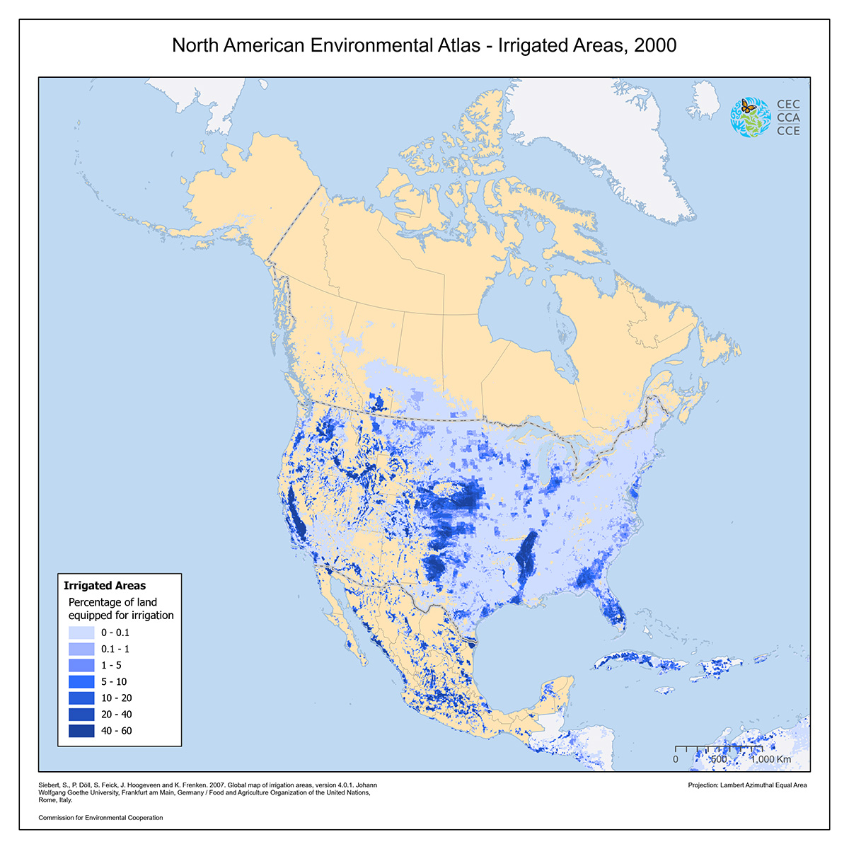
This map shows the percentage of the total land area that was equipped for irrigation, around the year 2000.
Irrigation is the practice of applying water to land to promote the growth of vegetation such as crops and pastures.
The land area actually irrigated is unknown but was smaller than the amount equipped for irrigation.
Source: Siebert, S., P. Döll, S. Feick, J. Hoogeveen and K. Frenken. 2007. Global map of irrigation areas, version 4.0.1. Johann Wolfgang Goethe University, Frankfurt am Main, Germany / Food and Agriculture Organization of the United Nations, Rome, Italy.

Contact
Questions about the North American Environmental Atlas? Contact:
Dominique Croteau
Project Lead, Geospatial and Environmental Information