North America’s Terrestrial Ecoregions
Happy #MapMonday!
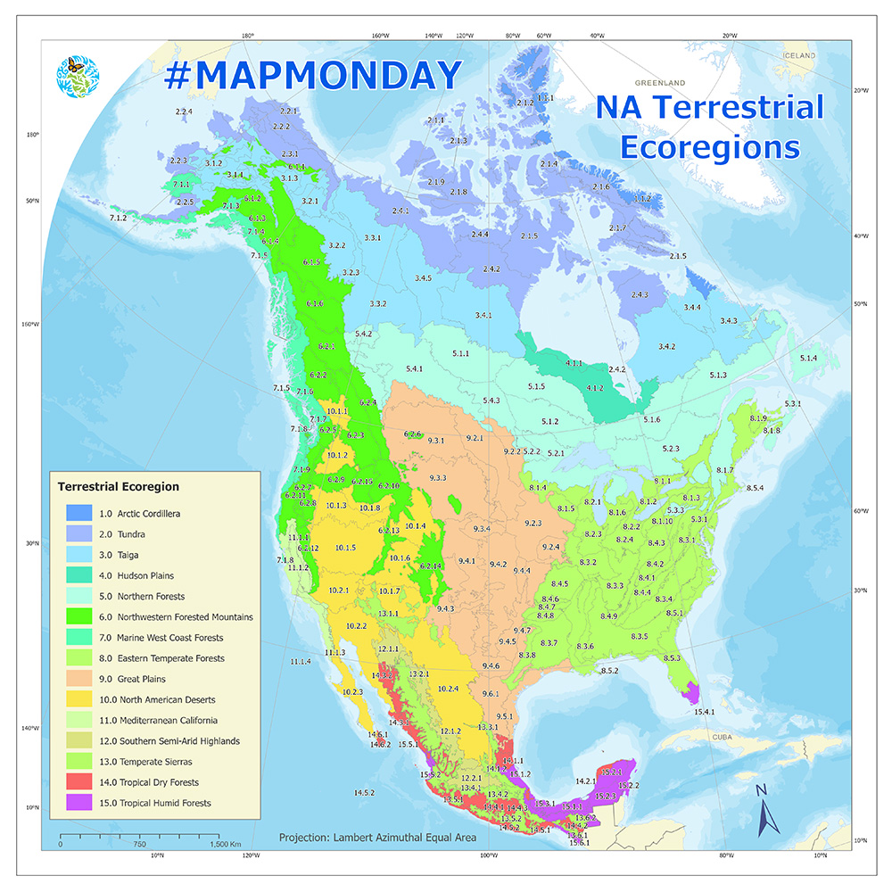
Did you know Commission for Environmental Cooperation has harmonized GIS data on North America’s Terrestrial Ecoregions, covering more than 21 million sq/km?!
3 levels of detail
I: 15 broad regions
II: w/ 50 regions
III: 182 detailed ecoregions
Check out the North American Environmental Atlas
This map also incorporates the newest version of the conterminous US ecoregions defined by the US Environmental Protection Agency (EPA).
You can also observe a variety of biological, physical and human factors that have modified ecosystems across North America.
This data set has detailed information on the location, climate, vegetation, hydrology, terrain, wildlife, and land use/human activities features in each ecoregion prepared by experts from Canada, the USA, and Mexico.